




Most people take their place in the world for granted. Standing in a grocery story isle deciding which cereal to buy or driving to work, the Earth feels static even though it is constantly changing. Continents shift, gravity fluctuates, water levels rise or fall and timing across the globe varies, but all that goes unnoticed to most unless their map app leads them to a bridge that is no longer there or off a dock into a lake or they lose all smartphone service.
Those who study geodesy, such as York University's Lassonde School of Engineering Professor Sunil Bisnath, understand the importance of the vast array of underlying systems, processes and geodetic and digital infrastructure needed to keep daily life and the world at large running smoothly, including for navigation, emergency response, banking and precision farming.
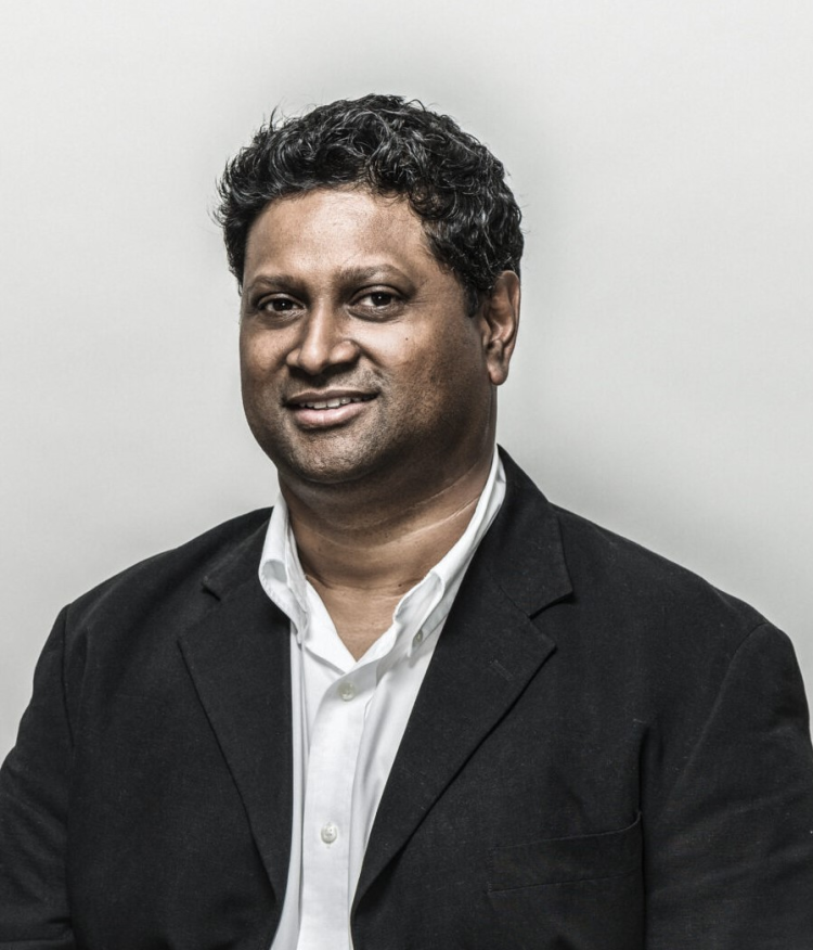
Sunil Bisnath
"The closest connection people have to geodesy every day is the Global Positioning System or GPS - satellite-based positioning that we use in our phones, our cars, and everything else. However, it goes much deeper than that," says Bisnath, director of the Global Navigation Satellite System Laboratory in the Department of Earth and Space Science and Engineering.
He was recently appointed by the Council of Canadian Academies (CCA) to an expert panel -Enhancing Canada's Geodetic Infrastructure - to assess the state of Canada's geodetic infrastructure. The panel, sponsored by Natural Resources Canada, will review whether Canada has sufficient geodetic infrastructure to meet its current and future needs and opportunities for renewed domestic investment. The main question: How does geodetic infrastructure impact Canada and its economy?
Global Navigation Satellite Systems (GNSS), which includes GPS and other satellite constellations, not only affects how Canadians navigate their world, but also ensure maps line up from country to country, the world's time clocks are aligned so things like bank transactions are stamped with the correct time, and electrical transmission grids across the country are precisely synchronized to keep the power on.
"Every time you make a financial transaction, a stock trade or somebody turns the lights on in their house, we're using the timing component to timestamp everything and to manage the electrical grids to ensure there's not too much or not enough electricity. We're using time servers attached to GPS time to get the time right on our computers so that we're all using the same time down to nanoseconds. Today, there's a huge amount of digital infrastructure," says Bisnath.
"Geodesy is a really old but highly important science. Without it, many of the things we take for granted today would no longer work."
Geodesy involves measuring the Earth's size, shape, orientation and gravity field, and any changes over time, as well as timing, while geodetic infrastructure is the backbone for positioning activities on Earth. It also helps to monitor things such as climate change, coastal hazards and sea level changes.
Canada's geodetic infrastructure, as dual-use technology, is important as it has national implications for sovereignty, security, including Arctic security, economic development and scientific advancement. Like most countries, Canada has physical stations on the ground to receive signals from satellites and provide calibration information, while other positioning technologies use natural signals from space, such as quasars or laser ranging from specialized satellites to determine position on the ground.
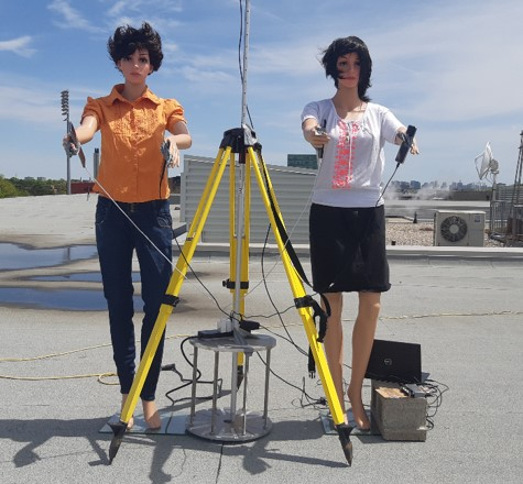
Rooftop mannequins hold smartphones to help determine positioning using GNSS
Currently, Canada is the only G7 country without its own satellite navigation system. Instead, it relies on the United States, Russia, Europe and China, along with aging geodetic infrastructure across the country, which in today's ruptured world order heightens national security and sovereignty concerns.
"Canada's reliance on others means it doesn't have the capacity to keep critical systems running nationally when interruptions happen and neither can it contribute to global efforts. The current situation also has implications for economic development and scientific advancement," says Bisnath.
"Our purpose for the panel is to gather all the facts and talk about what the state of geodetic infrastructure is in Canada and put that in context with the world going forward, figuring out what are we doing well and where are the gaps."
His research at York involves GNSS measurement processing, including the use of artificial intelligence (AI) and sensor fusion for resilient positioning, navigation and timing, next generation solutions, precise point positioning algorithm development, measurement error mitigation, and scientific, engineering and mass market applications.
He also researches how to improve atmospheric modelling for commercial GNSS navigation services, the effectiveness of new jam-resistant GNSS antennas and enhanced GNSS-based smartphone positioning with AI. By using math and physics which frames and defines how positioning, navigation and timing happens globally, the current and future digital infrastructure is being built.
If any of that is out of whack, it could cause major issues. "If you think of something like a commercial airliner, the technology used is not just to know how to get to the other side of the Atlantic, but for lining up the plane for landing. It's taxing on the runway and which runway you should be on," says Bisnath. "If they weren't aligned, a plane could take off with one map from say Paris and then try to land with that map in Toronto, but if the coordinates don't match, then how is that plane going to land on the runway?"
All these definitions are the basis of what used to be paper maps, now digital maps and smartphone apps, like Google Maps. "They need constant updating as the planet is far from static. We're moving about a centimetre a year further from Europe every year because the continents are moving apart. A very large part of the job of the federal government's Canadian Geodetic Survey is maintaining Canada's spatial reference system, which every country has, being the custodian of all these definitions and maintaining these definitions over time," he says.
As the world's weather intensifies, phenomena like solar storms become more problematic. Some of the work Bisnath and his team do at York is monitor GNSS data to help predict or mitigate any impact of the next solar storm on GNSS positioning, navigation and timing, and hopefully lessen its effect on signals from space that people rely on, including, smartphones and for the ever-increasing number of autonomous and semi-autonomous land vehicles, robots and drones.
Bisnath and his team have recently worked with a Canadian GNSS receiver manufacturer to better model those storms and their effects on signals using AI to help with predictive models to produce better positioning and timing results. "If the storms are really bad, they can prevent us from tracking the signals altogether, though that's quite extreme. When you add up what the cost would be of losing technology like GPS, even for short periods of time, it theoretically rapidly runs into the billions of dollars a day in Canada."
They are also working with a Canadian manufacturer of GNSS antennas as they are needed to receive signals before it can go into the actual GNSS sensor that processes them. The company has designed and built new low-cost antennas, which Bisnath and his team are assessing to see how they work under various conditions, including system jamming. Some of those antennas are being used on allied drones in active war zones.
"These information systems are like pyramids. If the user is at the top with their smartphone, we have layers of information underneath it to define all the coordinates on that map and at the base layer is what the geodetic work does. It needs to be very precise over very large areas and interconnected with the rest of the world."
It's a field of study that continues to interest Bisnath. He originally wanted to be a land surveyor, but his first course on geodesy, considered the most difficult course in the land surveying program, fascinated him. "When we start looking at the entire globe versus just tiny little pieces of it, the math is much more complicated. The Earth isn't exactly a sphere, so the mathematics are very complicated, but that's the underpinning for everything. Then we started studying satellites and satellite orbits because of technologies like GPS and satellite laser ranging." He was hooked.
"It was very expensive back in the 1990s and not something that the general public knew about. We were using the technology for very precise things, for surveying, engineering work and certain timing applications. The public never saw any of this technology. One of the early projects I worked on was a Canadian Space Agency analysis of what if we put a GPS receiver on a satellite to determine the location of the satellite," he says. "It was novel back then, although common place now." There are now some 14,000 satellites orbiting Earth with many more proposed.
"Over the last decade, the engineering challenge has been to get super accurate coordinates out of much cheaper hardware, where hardware cost cents rather than thousands of dollars. That continues to be a tremendous engineering challenge," he says. "How can we improve the positioning performance and when does it degrade? We're introducing AI approaches to try to deal with the extreme outliers that exist and to see if AI can take us any further," says Bisnath.
That includes positioning for autonomous vehicles.
And with increased technological advancement, comes bad actors, hackers who try to breach, jam or spoof these systems, like tricking a GPS receiver by broadcasting false signals like making it look like an oil tanker is on dry land. "What you're seeing in Ukraine or right now in the Persian Gulf is there are systems that don't necessarily work properly or don't work at all because of nefarious actors. We are building countermeasures for such situations to make more resilient technological solutions?"
Despite being a part of an exciting, growing and increasingly important field, Bisnath says the most rewarding part is working with students, conducting research with them and preparing them to lead the way. "They are the future of technological innovations to keep the world running safely and smoothly and on time," he says.


