Today's (Nov 6) cutting-edge geospatial technology is being utilized to honour and protect the past through a collaborative research project between the University of Lethbridge and Vulcan County.
The initiative, Locating Missing Grave Sites using Remote Piloted Aircraft Systems, involves the use of advanced geospatial technology to locate and document potentially lost grave sites, enriching our understanding of local history and providing a respectful approach to cemetery management.

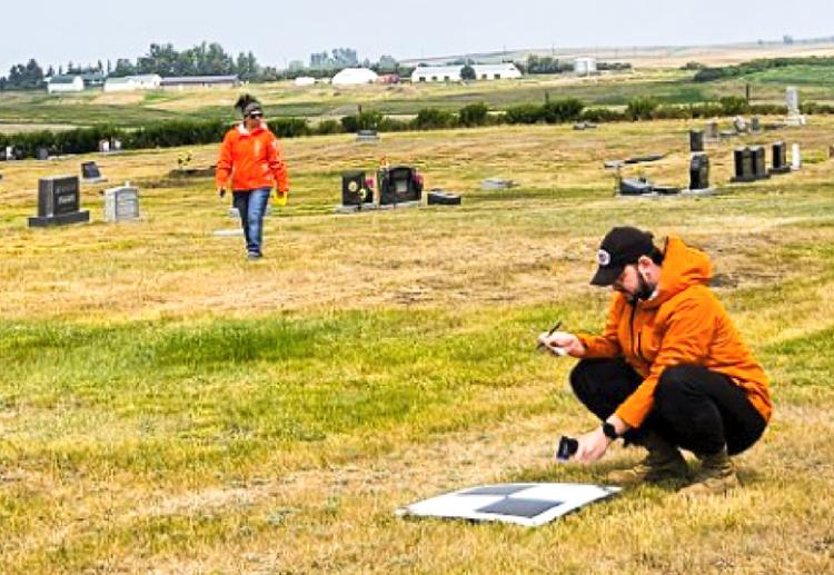
Researchers work in a rural cemetery collecting data as part of the collaborative community project.
"Unmarked graves have posed a significant challenge for rural communities for years. In Vulcan County, many of the cemeteries, which were associated with small towns, are now the responsibility of the municipalities and local service organizations to maintain, and many of these cemeteries have markers that have gone missing or were never recorded," says Christopher Northcott, Vulcan County. "The absence of accurate records and mapping has not only hindered cemetery expansion but made it more likely for historical graves to be unintentionally disturbed during excavations."
Research intern Paul Novoseltzev and a team of ULethbridge students under the guidance of Dr. Craig Coburn (geography & environment) will use a remote piloted aircraft system equipped with multispectral and thermal imaging technology, as well as terrain analysis using topography rendered from Structure from Motion (SfM), to locate missing graves throughout the county.
"Using these technologies, we will be able to conduct non-destructive and cost-effective surveys of potential grave sites," says Novoseltzev. "We hope to be able to identify graves that may have been lost to time and, in the process, update municipal records and create detailed maps that will prevent future disturbances of these sacred sites."
The project is funded in part by a $15,000 gift from Mitacs, a non-profit national research organization, with the other half of the funding coming from municipal stakeholders including Vulcan County, and the villages of Carmangay, Lomond and Milo. The Carmangay Historical Society, Carmangay Agricultural Society, Lions Club of Lomond and the Lions Club of Milo all rallied to support this important initiative, providing significant funding contributions.
"Partnerships such as these are extremely beneficial for both parties," says Coburn, professor and Chair of the Department of Geography & Environment. "The experience our students get from applying the technology they are working with in a field setting and then interpreting the data they accrue is invaluable. Similarly, we are able to help resolve an important issue for these communities as they seek to celebrate and preserve their rich histories."
To date, this project has nearly completed all required remotely piloted drone flights. This has generated an enormous trove of accurate location-referenced images that also overlay temperature variations. While this data will provide the basis for research into the capabilities of remote sensing technologies, for these rural communities the data will help establish cemetery profiles on local geographic information systems, identifying lost graves and areas where further investigation is required. Local histories will also be reviewed to complete the historical context for technical findings in the research component.


