The Earth is large and always changing. Throughout history we've used maps to visualize our planet, and everyone has used Google Maps to get from Point A to B.
Researchers at the University of Calgary are raising the bar even further than Google, developing a software system that can do more than just visualize the planet's surface it can also understand what's going on beneath our feet and above the sky.
Dr. Faramarz Samavati, PhD, a professor in the Department of Computer Science, and PhD candidate Lakin Wecker, have been involved in the development of a 3D Digital Earth System to help better store and utilize the plethora of data retrieved by geospatial sensors.

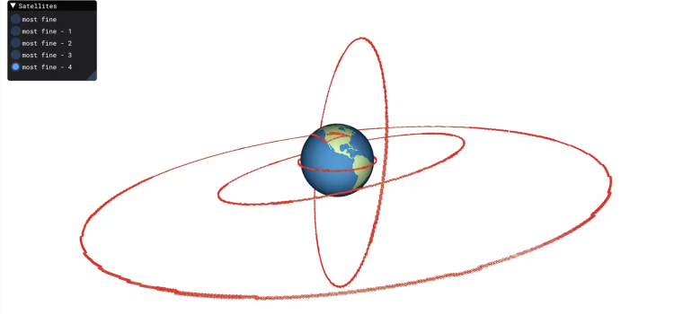
A satellite capture of the Earth via the Discrete Global Grid System. Courtesy of Faramarz Samavati
"Digital Earth System is a digital representation of the Earth," says Samavati. "So, you can imagine it's some kind of virtual globe. We can see the globe in 3D environments, but it can also store the vast amounts of geospatial data related to the Earth and make it easy to utilize.
"People have been using simple flat maps as their geographical information systems for many years. It was an interesting challenge to go beyond that."
Although geospatial sensors such as satellites and drones help collect the data that goes toward advancing how we visualize the Earth, Samavati says conventional geographical systems are still unable to fully utilize this data to make informed and timely decisions regarding our planet and many location-based applications.
For example, data collected by satellites can be used to monitor and measure wildfire risks and predict wildfire behaviour; it can also do this for other natural disasters. This is why Samavati is determined to contribute to the advancement of the Digital Earth System, as it can assist these existing systems, leading to better decision-making related to the planet. It'll allow for more accurate and timely predictions of when natural disasters could occur.
"With the help of this advanced system, we aim to answer the question: What's happening beyond the Earth's surface, from underground to the atmosphere?" says Samavati.
Both researchers play large roles at BigGeo, a company focused on innovation, using technologies to address geospatial questions, and making sure their stakeholders can understand geospatial data to make well-informed global decisions. As lead scientist and chief technology officer, respectively, Samavati and Wecker believe that much of what they do as researchers in computer science relates to geospatial data.
"We're talking about how to deal with information that's on the Earth, we're dealing with how things are related to each other," says Wecker, BSc'04, MSc'07. "And it turns out the mathematics from computer graphics are very valuable when dealing with geospatial data."
Samavati says he's really felt the support from UCalgary and the Faculty of Science specifically throughout the research, innovation and technology-transfer process.
"As a researcher, we always need funding and access to talent, and the university has been great in that regard," says Samavati.
Adds Wecker: "It's an area filled with opportunity for innovation."
Constantly dealing with imperfect data related to the Digital Earth System has made both researchers realize the importance of making the data accessible and easier to follow. By further understanding the Earth, more-informed decisions can be made related to it.
"There's so much data that has associated geospatial information that our work impacts pretty much every industry," says Wecker. "We have stakeholders and decision-makers and the public themselves who want to make decisions but, if they can't see the data, they don't even know what they have.
"At BigGeo, we're looking at more efficient ways to be able to visualize vast amounts of geospatial data."


