

A Memorial researcher is harnessing the power of earthquakes to create a 3D model of the subsurface of Newfoundland, down to an almost 250-kilometre depth.
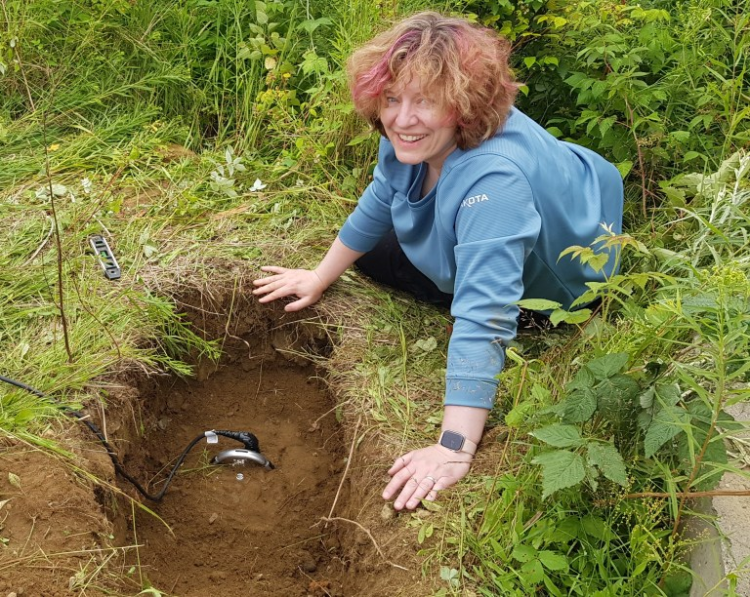
Dr. Kim Welford burying a seismometer near Valentine Lake, N.L. Photo: Submitted
That's about the distance between Corner Brook and Grand-Falls Windsor.
Dr. Kim Welford, a professor in the Department of Earth Sciences, Faculty of Science, and her collaborators, including community members, students, and researchers from the Université du Québec à Montréal and Yale University, are recording seismic energy from distant earthquakes to develop their modelling.
"It's basically like doing an MRI scan of the Island of Newfoundland," said Dr. Welford.
This study represents the largest and deepest probing geophysical survey of the island.
"The fact that this has never been done at this scale represents a massive gap in our knowledge of the province and how it was formed through tectonic processes."
The resulting 3D view of the island's deep structures will help the team learn how they were assembled during the formation of the Earth's last supercontinent, Pangea.
"It's basically like doing an MRI scan of the Island of Newfoundland." Dr. Kim Welford
Information collected through the survey will also shed light on the processes that formed critical minerals necessary for the greening of the economy, and where to find these minerals at the Earth's surface.
'Groundbreaking' study
Researchers and students successfully deployed a passive seismic array of 22 stations across the island in July 2025.
They call the initiative the PACMIN Project (Passive Array for Critical Minerals on the Island of Newfoundland).

Topography and bathymetry maps of (A) eastern Canada and (B) the Island of Newfoundland. The red stars indicate the locations of the PACMIN seismic stations and the yellow stars are the permanent seismic stations maintained by the Geological Survey of Canada. Photo: Submitted
The stations will record seismic waves from distant earthquakes using sensitive seismometers and use the waves to extract information about how the rocks from the Earth's crust down to the upper mantle vary beneath the island.
Each of the seismometers is equipped with sensors to track ground shaking in three directions: vertically, north-south and east-west.
"Our instruments are sensitive enough to record distant earthquakes with moment magnitudes of 6 or more, and to detect even smaller local earthquakes," said Dr. Welford.
Coincidentally, the full array was live and listening just hours before the 8.8 magnitude earthquake in Kamchatka, Russia, occurred on July 30, 2025. It was the sixth-largest earthquake ever recorded by scientific instruments.
The team distributed the instruments across the island as evenly as possible and secured installation sites in national and provincial parks, in government buildings, in corporate buildings, in homes, and on private property.
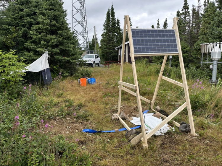
PACMIN seismic station (code name NOVA) in Terra Nova National Park. The seismometer and recording equipment are buried, with the solar panel providing continuous power from above. Photo: Submitted
"We are tremendously thankful to everyone who is currently hosting a site," Dr. Welford said. "They are contributing tremendously to our deep knowledge of the island."
Using the technology and combining their results from previous studies, the team will construct models of the full lithospheric structure of North America's eastern seaboard, all the way from the southeastern United States to the Island of Newfoundland, tracing the roots of the 480- to 260-million-year-old Appalachian Mountains.
Teamwork
The PACMIN Project is a joint initiative involving Memorial University, Dr. Fiona Darbyshire, a professor at Université du Québec à Montréal, and Dr. Maureen Long, a professor at Yale University, who was heavily involved in similar seismic experiments in the eastern United States as part of the 15-year USArray program.
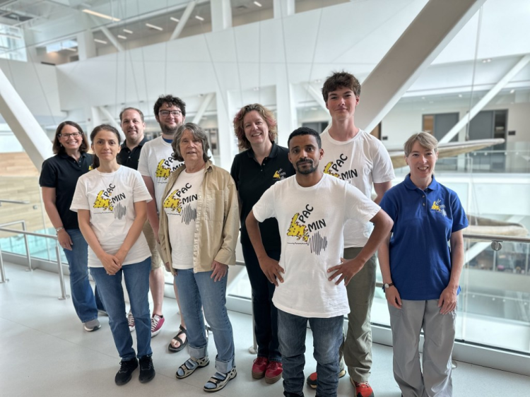
From left is the PACMIN team Maureen Long, Mitra Kangazian, Frederik Link, Benjamin Roque, Alison Leitch, Kim Welford, Wubamlak Nigussie Alehegn, Gavin White, and Fiona Darbyshire.
Photo: Submitted
"This is a key region for exploring the continuity of the eastern Appalachian Mountain belt," said Dr. Darbyshire, "and the relationship between Newfoundland's complex surface geology and its deep structure, as well as the links between the Appalachians and corresponding structures in Scotland, Ireland and Scandinavia, which predate the opening of the Atlantic Ocean."
Several students also took part in the deployment of the seismic stations.
Gavin White, a Memorial University undergraduate student, was hired as a field assistant and several graduate students volunteered. A post-doctoral fellow from the University of Mainz, Germany, also participated in the deployment team.
"This was an excellent opportunity to gain hands-on experience in the field and to be a part of new geophysical research here on the island," said Mr. White.
Future goals
The first year's worth of data will be collected this summer, which will be used to build the preliminary subsurface models.
The team will then download the remaining data and demobilize the sites in 2027.
"Everything that we discover during this project will be brand new knowledge as this kind of experiment has never been attempted on the island before," said Dr. Welford.
Once the large island-scale model tells the team members where to look, they hope to revisit key areas and perform higher-resolution experiments.
Funding for this experiment was provided by the Targeted Geoscience Initiative program of Natural Resources Canada, with additional financial support from Yale University.
The instruments for the experiment were provided by the U.S.-based EarthScope Primary Instrument Center.
For more information
230 Elizabeth Avenue
St. John's Newfoundland
Canada A1C 5S7
www.mun.ca