


"It's like mowing the lawn but with icebergs," explained Kevin Wilcox (BScME'06, D-TME'08, PhD'11), a research scientist with the University of New Brunswick's (UNB) Ocean Mapping Group.
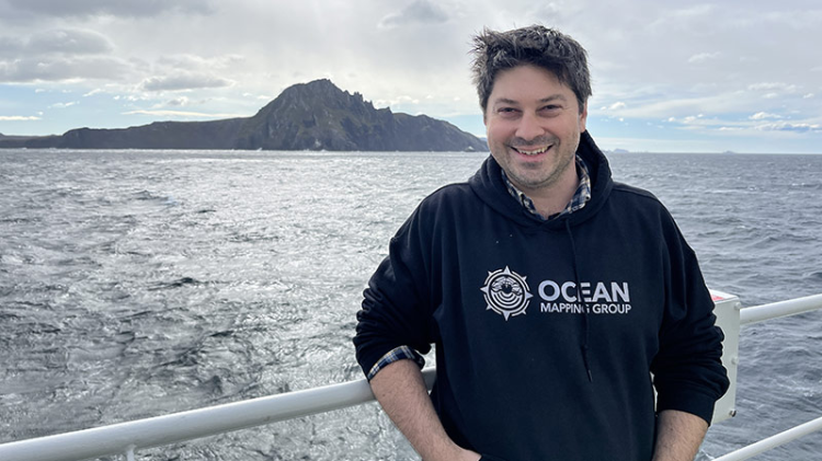
On Canada's first all-Canadian expedition to Antarctica, UNB researcher Kevin Wilcox conducted sonar surveys on the sea floor collecting critical climate data, dodging icebergs and spotting penguins along the way.
He's describing piloting the uncrewed surface vessel, or USV, used to map the ocean floor as part of the very first all-Canadian expedition to Antarctica.
"It was awe-inspiring!" he said of his first scientific survey on the remote, ice-bound continent. "There were penguins jumping around the boat as I was piloting the USV. Every once in a while I'd stop and take my camera out to capture it because, you know, penguins are science too."
As part of Operation PROJECTION, Wilcox joined a number of other Canadian scientists, each with a niche specialty to record and measure changes in Antarctica, with a particular emphasis on correlating observations to climate change.
Deployed on a MRRB (Multi Role Rescue Boat) from the Canadian Navy ship HMCS Margaret Brooke, Wilcox used a remote control to systematically map the sea floor, using the USV - a complex, two metre-long, sonar mapping tool. The data recorded will help the team, and others around the world, to better understand the underwater geography of this nearly inaccessible part of the world.
"There were three main surveys that I did, and they each touched on something a little different," Wilcox explained. "There were two purposes. First, some of these areas hadn't been surveyed in that detail before. Second, we were looking for areas called sunken beaches."
Exactly as it is described, a sunken beach would be evidence of a significant rise in sea level in the past, submerging a former coastline.
"I was scanning under the water to see if there were any geological features that would suggest that there was a beach below the current water line. At the same time there were others who were looking above sea level for geological evidence of beaches there."
The team also went to Deception Island, a volcanic zone that had previously been mapped. The island itself is a caldera, the sunken crater at the middle of the volcano that spews lava when it's erupting. The caldera itself in this case is almost completely under water with the crescent shaped island formed by the edges. Within the main caldera, the team mapped a smaller underwater volcano beginning to emerge from the sea floor.
"We wanted to see if there had been any changes to its shape or structure that would suggest that there was something active happening," Wilcox explained.
The last area surveyed held a previously placed active sensor, in a lagoon at the base of a glacier.
"There's quite a bit happening there because you've got the fresh water glacial melt, but then the lagoon is open to the ocean so you've got the saltwater coming in as well. It's a fairly biologically active area," he said. He was able to complete a partial map of this zone, before getting caught in a kelp bed, one of the many hazards of an ocean mapping expedition.
UNB's engineering team customized the submersible sonar unit used to conduct the surveys.
"We started with an empty shell of a boat and built all of the equipment on it. We work with companies that sell these commercially, but ours is 96% custom just trying to improve on all the little pieces that we can improve in some way," said Ian Church (BScEng'06, MScEng'09, PhD'14), associate professor of geodesy and geomatics engineering who leads the Ocean Mapping Group at UNB.
The data collected will be shared with academic and government partners around the world, especially in the areas surrounding the Antarctic region.
"The idea is to make the data available to anyone who would want it. Especially in those areas where Kevin was collecting data, they are close to other research bases," Church said. "The plan would be to make it widely available through online open data catalogs."
Testing the limits of the USV in the harsh Antarctic conditions and collecting data from remote regions are two big accomplishments for the UNB Ocean Mapping Group. But for Wilcox, the awe and wonder of visiting this far-flung, majestic continent is the biggest highlight of this expedition.
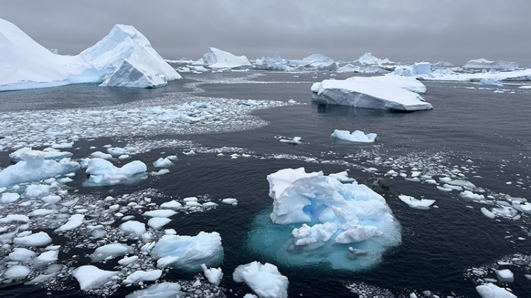
"We were finishing crossing the Drake Passage and we knew that land had been sighted after three days of crossing the open ocean, then we saw this little spec of white on the horizon," Wilcox recalled of the ship's entry into Admiralty Bay.
"At first you think that it's probably just an iceberg. But then it gets closer and closer, and before you know it there's this giant island of ice. You realize we're sailing into that! It's hundreds of metres high of glaciers all around you. The blue colour of it is very unique and captivating."
"That was my Oh, we're in Antarctica now' moment!"