


By Megan Stacey
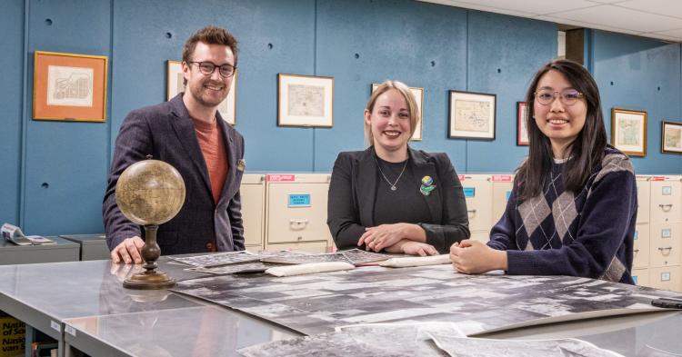
Map librarian Zack MacDonald, GIS specialist Liz Sutherland and student library assistant Eunice Chu (L to R), in Western Libraries' Map and Data Centre. Chu created an app to share historical air photos from across Southwestern Ontario. Those images are among the historical materials housed at the Map and Data Centre, including topographical maps, original fire insurance plans and more than 60,000 aerial photographs. (Christopher Kindratsky/Western Communications)
A new app making thousands of historical photos - captured from the skies - accessible to the public with just a few clicks will offer a unique glimpse into Southwestern Ontario's past.
Watch as Highway 401 radically develops the south end of London. Pinpoint family farms or town landmarks in Elgin, Middlesex, Oxford and Perth counties and watch them change through the years.
The uses are nearly endless: From history buffs to curious citizens, the application developed by Western Libraries opens an entire new world of local knowledge.
"For people who aren't professionals in history, these photos are especially cool," said Eunice Chu, a student library assistant at the Map and Data Centre in Weldon Library.
Chu, a fourth-year student specializing in geographic information science, built the application in six months.
"Anyone who has a computer or a phone can access the materials. It makes it very convenient for people who don't do professional research - anyone who wants to understand the differences between the historical photos and the present day can use the app," she said.
The images represent one of the largest air photo collections in Canada. There are more than 10,000 available through the app and roughly 60,000 in Western Libraries' Map and Data Centre.
Many come from the National Air Photo Library - government photos from planes flown to collect data from above. Other organizations, like the Upper Thames River Conservation Authority (UTRCA) - which tracks the watershed, such as flood plain areas - also shared their images.
"People started flying because that was the only way to get data from top down. Satellite resolution really wasn't that great until very recently. To see houses and concessions, you needed to fly an airplane to get air photos," said Liz Sutherland, Western Libraries GIS specialist.
Today, those photos represent a valuable archive of local history.
"It's information you wouldn't be able to get anywhere else. It's in our nature to want to see what things used to look like. Even beyond research, it allows people to explore what their neighbourhood looked like, what their town looked like," Sutherland said.
Western collection used globally
Those top-down images include a wealth of data, including the organization that sponsored the flight, when the photo was taken and any other details attached to the shot. Some are even geo-referenced, meaning they're attached to real-world coordinates to allow for mapping and further analysis.
Professionals are using the app and its photos to illustrate and analyze agricultural changes, erosion, or research ahead of new construction projects. The UTRCA recently used the app to quickly locate past images of the Sifton Bog.
The easy-to-use app with an expanded collection - covering a large swath of the Southwestern Ontario region - is expected to be used by historians, building consultants and planners, academic researchers and interested community members.
The app allows users to search photos and narrow the results using filters. It's much easier, and cheaper, than requesting scanned images from the Map and Data Centre, which was time-consuming for staff.
Chu was able to elevate her GIS skills while building the app and even presented her work to professionals in the community, making the most out of her contract at the library.
It gave a huge boost to the team at the Map and Data Centre, too, map librarian Zack MacDonald said.
Making GIS fun
One of the most compelling features of the app is its ability to break down geographic information systems, or GIS, with an easy-to-understand concept.
"It's a fun way to encourage people to experiment with GIS. We're all just addicted to GIS," MacDonald said of the team.
The app was developed using ArcGIS Dashboards, a platform students, staff and faculty at Western can use to create their own applications. It's the same system that gives life to Story Maps, which provide highly visual and engaging representations of research in numerous fields.
Western Libraries pays for a subscription and offers live and virtual training, including demonstrations and workshops.
MacDonald calls it a powerful tool.
It's easy to experiment with analysis, even for an amateur, thanks to a measurement tool that shows the distance between features in a photo.
Treasure trove of data
Air photo data can be used as a layer of information alongside modern-day satellite imagery, topographical maps, even fire insurance plans from the 1800s outlining original details of every property.
But creating a "Dashboard" like the one Chu made to house the air photos can be as simple as an archive of vacation photos.
"It's expanding to users we wouldn't necessarily have had before," MacDonald said.
The library is eager to educate the Western community about the opportunities of the software with its training tools.
The air photo app is the perfect example.
"People are engaging and learning a little bit about GIS, even if they don't realize. I like being able to introduce people to it without overwhelming them with a ton of definitions and science," Sutherland said.
"It highlights the usefulness of GIS. You're engaging with geography and spatial data in a way that's really easy: you just open the app, you load a photo, you take a look at it, and you're engaging with GIS. I love that."
